
Recent warm days do not mean winter's over
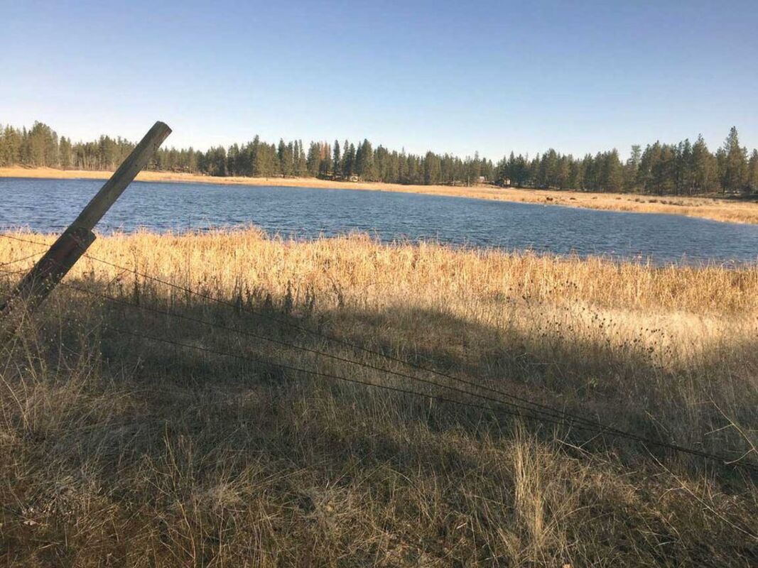
This Feb. 12 photo of an iceless Blue Heron Pond near Medical Lake shows how the past couple of weeks' slightly warmer weather has made us think spring.
They're playing golf at The Fairways, some flowers are starting to peek through the ground and, yes, even the occasional convertible with its top down is seen sometimes.
But while the last couple of weeks have given those prone to a case of "Spring Fever" the opportunity to wish that warmer days are here for good, both "Punxsutawney Phil" the groundhog back in Pennsylvania, and our own human weather expert, Dr. Bob Quinn cautions not so fast trying to get rid of winter.
But it was hard not to get spoiled with a string of temps that hovered in and near 50-degrees earlier in the month, topping out of 56 on Feb. 8. Especially since a year ago at this time the ground was still covered by snow that lingered for over 70 days.
Officially the spring equinox takes place about five weeks from now, at 9:15 a.m. on March 20, so be prepared any day to wake up to white. Even while reading this, you might be looking out the window at fresh snow as some of the talking weather heads say 4 – 6 inches sometime this week.
Quinn, a retired EWU geography professor of 49 years, and noted long-term weather forecasting expert, accurately predicted back in the fall of 2017 that this would be a slightly warmer than normal winter and it has.
"We can wake up and there's two or three inches of snow and a day-and-a-half later it's gone," Quinn said. What he sees over the next two months is "A benign pattern that will average normal precipitation."
He also said it would be near normal snowfall outside the door. And it is so far as just over 31 inches have fallen at the National Weather Service office near Spokane International Airport. Long-time averages set normal at about 45 inches, but there's still several weeks of calendar winter, followed by more of a snow season that stretches into April.
"We have a weak La Nina pattern but it's not behaving much like a La Nina which tends to be colder and occasionally snowier than normal," Quinn said. What's driving this is slightly warmer - about 2 degrees - North Pacific Ocean temperatures.
The systems that come down out of the Gulf of Alaska that would normally be cooler and snow pipelines have to move over the warm water pool, Quinn explained.
And lately it's been more rain with rivers, creeks and even agricultural fields teaming with snowmelt water. The recent warm spell zapped the low elevation snowpack, that being below 4,000 feet elevation. This is the snow that feeds some of the smaller streams like Latah Creek, the Palouse and Little Spokane rivers.
The Spokane River is having an early surge of high water with runoff from its tributaries like the Coeur d'Alene and St. Joe rivers. Expect more of that, however, as a predicted wet spring will continue to charge mid to high-mountain basins.
The Spokane River basin, for instance sits at slightly over 100 percent of normal when about this time in 2017 that was in the 70s, but rebounded nicely to finish over 110 percent.
California's one-year reprieve from the drought, where last year at this time their basins in the Sierras were teaming with some snow packs nearing 200 percent of average, is over. Currently, none are over 50 percent. And Oregon is experiencing similar conditions.
This is turning out to be a normal to slightly above normal precipitation event for higher elevations in the Pacific Northwest, down to about Northern California, Quinn said.
"From the Tahoe Basin southward, forget it," adding there is little relief predicted. "They'll take anything they can get."
Paul Delaney can be reached at pdelaney@cheneyfreepress.com.

Reader Comments(0)