
Super-soaker spring
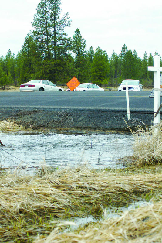
Water gushes from a culvert under Salnave Road where it intersects with the curently-closed Graham Road. The cars in the background belong to homeowners living north of Salnave on Graham, which is also closed with water over the roadway.
By the calendar at least, the winter that never seemed to go away officially ended March 20.
But don't let that fool anyone. There's still plenty more of the wet to be experienced in the months ahead leading to summer. Maybe there's even some white?
The past three months of winter - well 79 days at least since the calendar turned 2017 - have been wet and no one needs to remind any area residents of that.
How wet was it? "Unusually wet," retired Eastern Washington University professor of geography, and a crack long-term meteorologist, Dr. Bob Quinn said on the first day of spring. So far the precipitation totals for just that span of time have hit slightly over 17 inches, a number that surpasses the average totals recorded for a typical year at the National Weather Service office on the West Plains.
Included in that number is 61 inches of snow, well surpassing the average of 45 that blankets the area in a La Niña winter fueled by colder than normal sea surface temperatures.
The good news, Quinn said, "We're almost done with the snow at the lower elevations."
In the long term, as spring gets rolling, the weather will be basically a continuation of what has been seen already, "Cool, wet," Quinn said. He sees no changes in the North Pacific storm track that has influenced weather for several months.
"We've seen, which is approaching for us anyway, in the lowlands, what is the wettest winter in recorded history," Quinn said. It's at least in the top-three.
The La Niña, which replaced back-to-back warmer water El Niño's in 2014-15 and 2015-16, has been considered weak. But tell that to those who seemed to be endlessly shoveling from the first snowfall in late November.
In this La Niña year, the storms came down across the North Pacific, which in a traditional year - coming from the Aleutians, Gulf of Alaska and other areas - would deliver above normal snowfall and a colder than normal winter.
But there's an immense pool of water in the North Pacific that is slightly warmer than normal.
"It's not been a frigid, Arctic-dominated winter, but it's been cooler than normal," Quinn said. "The big effect is that it keeps adding more moisture to the storms."
What's at work is an old basic tenet of grade school science where warm air rises, forming clouds, which in turn can produce moisture. Warmer water adds more moisture with more vertical motion and better cloud development, Quinn explained.
The warm pool is something that began to show last fall when October set records for the most precipitation for the month in recorded history as 6.21 inches of precipitation rained down. The previous mark was 1947's 5.41 and the total topped the previous record for any month of 5.87, set in 1897.
Looking into the immediate future, "The nice, juicy, wet Pacific storm track is going to continue," Quinn said. "We'll be a little more toward what I call a cold and unstable spring, showery, some grapple and even a remote chance of cold thunderstorms," he added.
Further down the line, Quinn predicts a fairly strong and active early spring storm track that continues to deliver above normal precipitation.
That means high and mid-level snow pack will continue to build from what has been relatively normal amounts so far.
"We of course took off a bunch of the low elevation snowpack two weeks ago," Quinn said, speaking of that which is found from 2,500 to 3,500 feet.
Most all river basins across the entire Pacific Northwest still maintain normal to slightly above normal snow packs at 90–120 percent.
The wet winter in the lowlands has not translated to the higher elevations. Snow produced in the higher elevations was of a colder variety, which has less water content.
Paul Delaney can be reached at pdelaney@cheneyfreepress.com.

Reader Comments(0)