
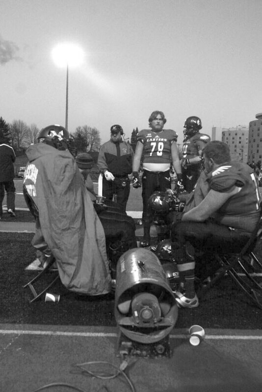
Eastern Washington University's football team deployed additional propane heaters to keep players warm last Saturday.
The record bitter cold the Eastern Washington football team played in, and over 6,100 fans endured last Saturday at Roos Field was the kind the area has not seen in nearly two years.
Game time temperatures were hovering at 12 degrees – the coldest EWU has ever played – and dipped to single digits according to some local thermometers not long after the finish.
And according to EWU meteorology professor and noted long-term weather forecaster, Bob Quinn, the Arctic outbreak while not predicted earlier, was not to be unexpected with everything that plays into Northwest weather.
"Basically we had the big high pressure ridge that was over us for the last 7-10 days and it retrograded just off the coast," Quinn explained. The ridge pushed all the way into the Yukon and that turned on the Arctic air conditioner. Steady winds made it feel much worse.
This is not unusual in winter, or even late fall for that matter.
"What's unusual is once about every 10 years that becomes the dominant weather pattern all winter long," Quinn explained. "Then you end up like a '78-79 where you have one of those bitterly cold, not necessarily heavy snow winters because it's so dry."
But not to worry, Quinn said. The models show this ridge is going to go away.
"By (this past) Tuesday night we have a pretty big low that comes right up to the coast, the ridge basically disappears, so we end up with more of a North Pacific trough pattern out of the Gulf of Alaska," Quinn said.
As that low comes in the big question is how much snow might the system deposit?
That will be determined if the low ends up sitting along the Washington/British Columbia coast. "Then we get abundant moisture coming in with a lot of cold air in place," Quinn explained. "That results in a pretty heavy snow situation."
If the low takes up residence off the Oregon coast the area would still get snow likely prior to Saturday's 1 p.m. visit by the Jacksonville State Gamecocks from Alabama - where high temperatures range from between 60 to 78 degrees.
The area still will get snow but with a much longer trajectory over Oregon that wrings out some of the moisture, Quinn said.
"Either way we're going to get snow and my feeling is it's going to be quite a bit, at least for a given event," Quinn said.
The extended models keep what Quinn calls, "The North Pacific conveyor belt," which will bring a new system on board every 72 hours.
Paul Delaney can be reached at pdelaney@cheneyfreepress.com.

Reader Comments(0)